

Ono Island Unit Fifteen:
Bayou St. John, River Road & Canal Lots
A buyer’s reading of the April 1985 Unit Fifteen sheet — private Ono Boulevard and River Road, lots oriented to Bayou St. John and a 100-foot canal easement, and the Declaration notes that still frame ownership on this eastern Ono Island unit.
When I open a Unit Fifteen drawing with a buyer, I am looking for how Ono Boulevard and River Road organize the lots, how Bayou St. John and the canal easement shape the waterfront band, and which recorded notes still govern ownership — then we finish with survey, ACC, and title.
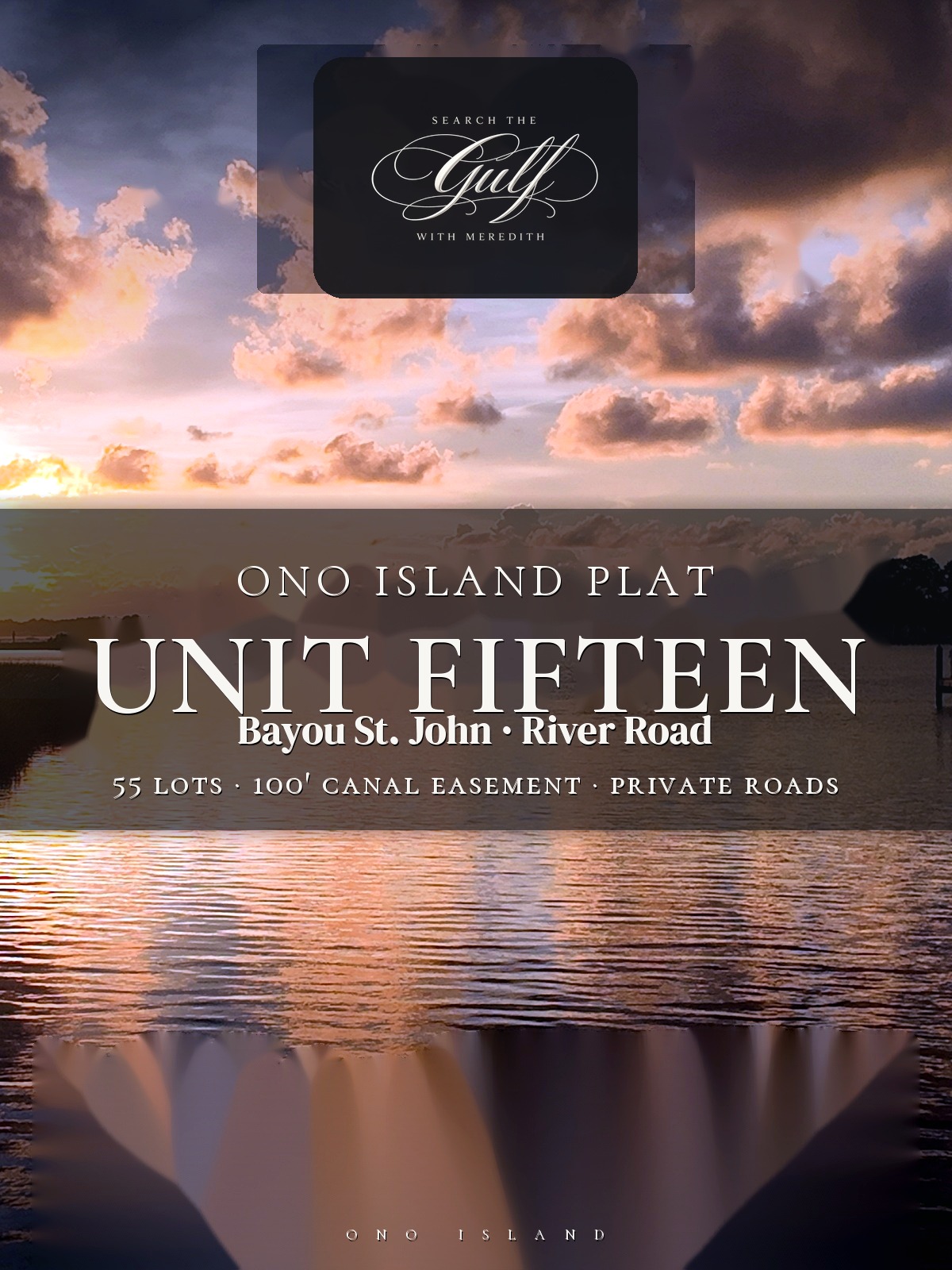
Unit Fifteen sits in the eastern Ono Island context between Bayou St. John and the broader island road system. Primary lot water on this sheet is Bayou St. John and the canal system — not Old River frontage. This page belongs to my Ono Island plats series. Pair it with the Buyer’s Guide, then browse current homes and land. For Bayou St. John inventory context, I keep Bayou St. John homes & land close at hand.
“Unit Fifteen is Bayou St. John and canal geometry on one April 1985 sheet — a private boulevard and River Road framework, a 100′ canal easement along the waterfront sweep, and Declaration language that keeps roads and canal rights inside the subdivision — not a general-public dedication.”
Recorded Plat at a Glance
Where Is Unit Fifteen?
Unit Fifteen sits on the eastern side of Ono Island in Baldwin County, in the Orange Beach area. The sheet organizes lots around private Ono Boulevard and River Road, with a waterfront / canal band along Bayou St. John. A legal-description / boundary callout references the southeast of Lot 167, Ono Island Subdivision Unit One (Map Book 7, pages 52–54) as adjoining-unit context.
Primary water for Unit Fifteen lots on this sheet is Bayou St. John and the canal system. I do not treat Old River as the lot waterfront here unless a buyer’s specific parcel is elsewhere on the island. For how Bayou St. John reads in today’s inventory, see my Bayou St. John homes & land page.
Vicinity context on related Ono Island drawings places the island between Bay La Launch to the north and the Gulf of Mexico to the south. That is inset / island context — not a substitute for the lot water labeled on this Unit Fifteen sheet. For how streets feel once you are oriented, I keep the Ono Island street guide nearby.
Explore River Road, Ono Boulevard & Bayou St. John
Use the interactive map to orient to River Road and Ono Boulevard on the Orange Beach / Ono Island side of Bayou St. John. Switch to satellite view for the clearest look at the shoreline, canal geometry, and present-day development.
Map note: Google Maps is provided for general geographic orientation. It does not display the recorded Unit Fifteen boundary, legal lot lines, easements, setbacks, mean-high-tide boundary, canal easement limits, or a surveyed building envelope.
How Many Lots Are Shown?
The title block prints NUMBER OF LOTS: 55. That is the count I use for this Unit Fifteen sheet — not a guess from partial lot-number bands on the drawing.
Layout on the sheet reads in bands rather than one simple grid: a River Road cluster, interior lots between the boulevard corridor and the waterfront band, and Bayou St. John / canal-front lots along the sweeping curve of the 100-foot canal easement. Some lots sit along the 100′ Ono Boulevard right-of-way; others turn with River Road. A label for a spoil area notes that certain spoil ground is not included in the platted lots.
Title-block facts buyers should keep: surveyor Polysurveying of Mobile, 2460 Government Boulevard; scale 1″ = 100′; April 1985; surveyed / certified by Sidney J. Orrell, Jr., Ala. Reg. No. 9982; owner Ono Development Co., Inc.; Sheet 1 of 1. Approvals and stamps on the sheet include Baldwin County Building Inspector, Planning Commission, Health Department, Engineering, Electric Membership, and Ono Water and Sewer Authority context around the mid-1980s recording window.
Lot Measurements and Geometry
Unit Fifteen lots are organized by road frontage and water / canal orientation rather than one uniform rectangle size. Bearings and distances appear on lot lines; a curve data table documents road and boundary curves with delta, radius, and tangent columns. Buyers do not need every cell memorized. They do need to know the roads and canal geometry were surveyed with curve data, not sketched freehand.
Dashed lines inside some lot boundaries may indicate easement or setback corridors on the drawing. I do not invent setback footages from those dashes. Current ACC guidelines, covenants, and a parcel-specific survey govern buildable area today.
| Plat Feature | What the Sheet Shows | Practical Meaning |
|---|---|---|
| Lot count | Title block: NUMBER OF LOTS 55 (Sheet 1 of 1). | Use the stamped total; confirm the specific lot on the recorded sheet. |
| Ono Boulevard | Labeled private corridor at 100′ R/W; temporary vehicular turn-around appears on the boulevard geometry. | Boulevard lots front a wide private right-of-way, not a public street dedication. |
| River Road | Branches from the boulevard; sheet labeling supports an ~80′ R/W where shown. | River Road lots read as their own cluster — confirm frontage on the recorded sheet. |
| Canal / water band | 100′ canal easement along Bayou St. John; mean-high-tide / south-margin language appears in notes and lot lines. | Waterfront usable area is not the same as the full platted polygon. |
| Road & boundary curves | Curve data table present (multiple curves with delta / radius / tangent). | Curved-road and canal-front lots may read differently front-to-rear than a rectangular sketch. |
A current survey still confirms what you are buying today. The plat is a foundational map layer — not a substitute for ACC review, covenants, title, or a parcel-specific survey.
What Does the Plat Say About Bayou St. John & the Canal?
On Unit Fifteen, the water story is Bayou St. John plus a platted 100-foot-wide canal easement. Lot lines and notes use mean-high-tide / south-margin language along the bayou. The legal description walks canal centerline geometry. Iron pipes are noted at lot corners adjacent to streets and as reference points where lot lines meet the canal easement.
A practical note on the sheet: the developer or engineers retain authority to close off the canal connection from the subdivision to Bayou St. John if water-quality problems arise that cannot be satisfactorily remedied. That is recorded context buyers should understand before assuming perpetual open canal connection.
A buyer should not use the drawing alone to determine present shoreline acreage, riparian limits, pier placement, bulkhead position, canal depth, or water quality. Those questions may require a current survey, title work, elevation information, permitting review, and site-specific guidance from the appropriate professionals. For inventory context on this water, return to Bayou St. John homes & land.
Ono Boulevard & River Road: A Private Road Framework
The primary roads on the Unit Fifteen sheet are ONO BOULEVARD — labeled at a 100′ right-of-way — and RIVER ROAD, with right-of-way shown in the ~80′ class where labeled on the sheet. A temporary vehicular turn-around is called out on the boulevard geometry.
Dedication language on this sheet is clear: roads, canal easements, and utility / maintenance / repair / drainage easements are not dedicated to the general public. Rights of use and enjoyment are granted to lot owners under the Declaration of General Covenants dated September 10, 1973, recorded in Miscellaneous Book 22, Page 399, Baldwin County Probate.
That matches the private Ono Island road system buyers should expect. Street maintenance, access rules, and related obligations still follow the Declaration / POA framework rather than a public-dedication model.
Are Easements Shown?
Yes. The Unit Fifteen sheet shows a prominent 100′ canal easement along the Bayou St. John / canal band. Utility, maintenance, repair, and drainage easements are addressed in the dedication and notes framework — reserved for subdivision use under the Declaration, not dedicated to the general public.
The developer reserves extensive canal-related rights on the sheet: ingress and egress over canals; excavate and remove material; spoil areas; widen, deepen, relocate, or otherwise alter canals and jetties; and grant related easements. Those reserved rights are part of the recorded picture buyers and counsel should review with title.
Dashed corridors inside some lots may mark additional easement or setback bands. For a purchase or construction decision, I would want the title commitment, all exception documents, and a current survey reviewed together.
Are There Building Setbacks?
This Unit Fifteen sheet does not lead with numeric building-setback distances printed as the main callout on every lot face. Dashed lines may indicate easement or setback corridors on the drawing, but I do not invent setback feet that are not cleanly labeled as building setbacks.
Buyers still look to the Declaration of General Covenants, ACC guidelines, current covenants, and a current survey for setback control — not to a freehand reading of every dashed line on a 1985 sheet.
Are There Common Elements?
The plat does not present “common elements” in the condominium sense. What it does establish is a system of shared private rights: subdivision owners may use the private roads and canal easement areas under the Declaration framework, and utility / drainage / maintenance / repair easements serve infrastructure functions for the subdivision.
Owner certificates frame Unit Fifteen as an addition to the Existing Properties under the Declaration. Owners of lots herein automatically become members of the Property Owners Association of Ono Island, Inc. and are obligated to pay maintenance and other assessments as provided in Article V of the Declaration of Covenants.
Title notes also place the subdivision in a flood hazard area as defined by the Federal Insurance Administration Baldwin County F.I.A. Flood Hazard Boundary Maps (date of identification on the sheet; Zone A-class / A-14 language appears in the flood note block). Flood-zone practice for insurance and building still needs current FEMA / elevation confirmation — the 1980s FIA callout is historical map context on this sheet.
On ownership-cost context, buyers should confirm current POA amounts through my Admission Fee guide. That page covers the one-time POA Admission Fee context on arm’s-length transfers and related ownership notes — amounts can change, so I prefer linking to the fee guide rather than inventing a figure here.
Questions I Would Answer Before Buying or Building
Which unit is this, and how many lots are on the sheet?
This is Ono Island Subdivision — Unit Fifteen, Baldwin County, Alabama. The title block prints NUMBER OF LOTS: 55 on Sheet 1 of 1 (April 1985, Polysurveying of Mobile; Sidney J. Orrell, Jr., Ala. Reg. 9982).
Are Ono Boulevard and River Road public on this plat?
No. Ono Boulevard is shown at a 100′ private right-of-way; River Road is shown with right-of-way in the ~80′ class where labeled. Dedication language states roads, canal easements, and utility / maintenance / drainage easements are not dedicated to the general public. Rights of use follow the Declaration dated September 10, 1973 (Misc. Book 22, Page 399).
What body of water do Unit Fifteen lots front?
Bayou St. John and the canal system. The sheet labels a 100′ canal easement and uses mean-high-tide / south-margin language along the bayou. This is not an Old River waterfront unit on the face of this sheet. Current water depth, canal connection, dock condition, and permits still need separate verification.
What should I know about the canal easement?
A 100-foot-wide canal easement is labeled along the waterfront band. Iron pipes mark corners and canal-easement intersections. Notes allow engineers / the developer to close the canal connection to Bayou St. John if water-quality problems cannot be remedied. The developer also reserves broad rights to excavate, spoil, widen, deepen, relocate canals and jetties, and grant related easements.
Does this sheet list building setback distances?
Not as a clean set of numeric building-line callouts on every lot face. Dashed lines may mark easement or setback corridors, but buildable area today still depends on ACC guidelines, current covenants, and a current survey — not an invented footage from the dashed lines alone.
Do Unit Fifteen owners join the POA?
Yes. The sheet frames these lots as an addition to the Existing Properties. Owners of lots herein automatically become members of the Property Owners Association of Ono Island, Inc., and are obligated to pay assessments under Article V of the Declaration. Confirm current POA amounts — including Admission Fee context — through the Admission Fee guide.
Are the 1985 dimensions enough for closing or construction?
No. They are valuable historical and legal context, but I would still use current title work and a parcel-specific survey — plus ACC review and current covenants — before any offer or build strategy. Flood-zone and elevation questions also need current confirmation beyond the sheet’s F.I.A. note.
Why Unit Fifteen Still Matters
Unit Fifteen is a revealing Bayou St. John chapter on Ono Island: a private boulevard and River Road framework, fifty-five lots stamped on the title block, a 100′ canal easement along the waterfront sweep, and Declaration language that keeps roads and canal rights inside the subdivision.
For me, the value is in reading the April 1985 sheet next to today’s survey, ACC, and title — then confirming water, easement, and ownership-cost questions before any offer strategy. Two addresses on the same road can look similar from the pavement and still differ in canal frontage, depth, elevation, improvements, and water access.
Considering a Unit Fifteen Property?
Call or text me with a Unit Fifteen lot number, River Road address, or Ono Boulevard address and I will help you read the plat next to the listing, canal and Bayou St. John questions, easements, and current survey.
Browse Ono Island homes for sale or land and lots while we talk through the map. Return to the plats hub for other recorded units.
SEARCH GULF COAST REAL ESTATEThe recorded plat is a starting point, not a substitute for a current survey, title examination, legal advice, engineering, permitting review, or written approval from the appropriate governing bodies.
A Simple Way to Connect
Text or Call Meredith
Have a question or need more information? Texting is often the easiest way to reach me, or you are always welcome to call. I am happy to help.
Gulf Coast real estate guidance | SearchTheGulf.com

A Personal Note from Meredith
Questions About This Topic?
If you would like to understand how the details in this article may relate to your property, your plans, or a Gulf Coast real estate decision, I would be glad to help.
Get in Touch with Meredith
Clear Answers Are Only a Text or Call Away
Texting is often the easiest way to reach me. You are also welcome to call whenever it is convenient. I am always happy to help you find the information you need.
Gulf Coast real estate guidance | SearchTheGulf.com
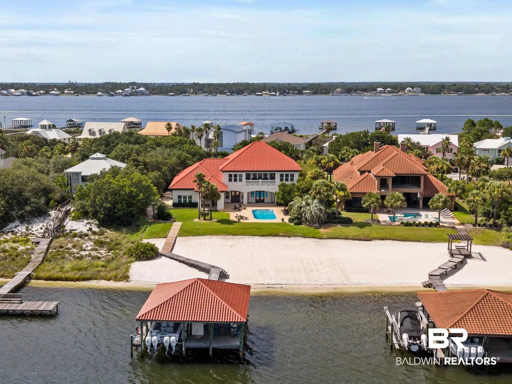
Ono Island Homes & Land for Sale – Luxury Waterfront Real Estate in Orange Beach Alabama





.gif)

Storm Prep on Ono Island — Watching Tropical Weather for Friday | Search The Gulf
Ono Island
Storm Prep on Ono Island — Watching Tropical Weather for Friday
A tropical system could reach the coast this Friday. Nothing is locked in yet—and on Ono, we do not wait for a last-minute scramble.
Ono Landing Launch vs Dock
On this page
Watching Friday’s weather
Boat launch…

Long Bayou Preserve Orange Beach: New Site Plan & Update
Ask A Question or Sign Up To See New Real Estate Listings Before Your Competition
When it comes to finding the home of your dreams in a fast-paced market, knowing about new listings as soon as they are available is part of our competitive advantage.Sign up to see new listings in an area or specific community. Contact Meredith with any questions you may have.