Complete Nautical Navigation Guide for Ono Island Boaters

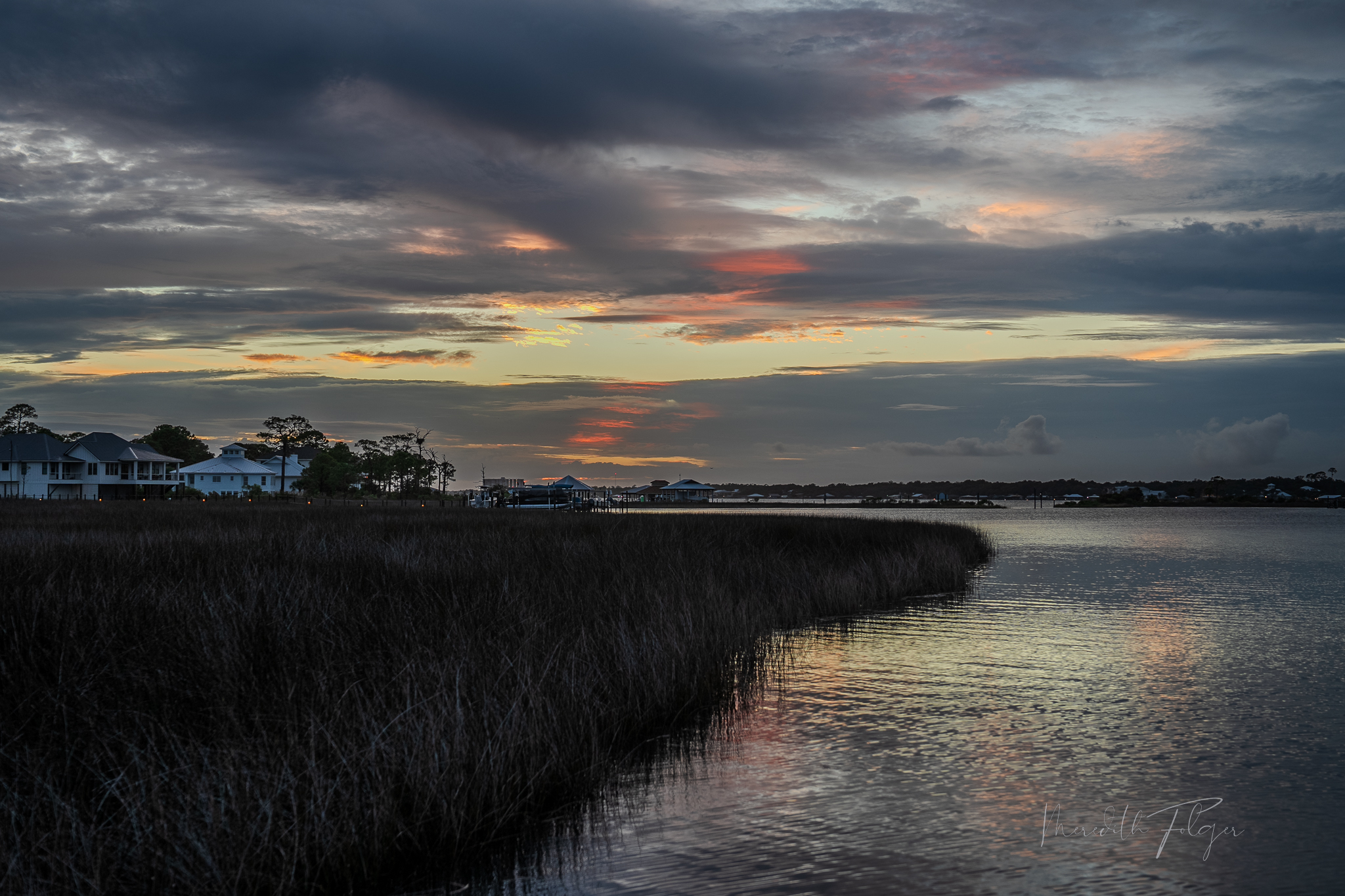
I’m Meredith Amon, an Ono Island homeowner and coastal navigator, and I’ve learned that exploring our Alabama–Florida Gulf Coast waters is equal parts art and science. From the calm back bays behind Ono Island to the swift currents of Perdido Pass, safe and elegant boating here means understanding the tides, the channels, and the character of each waterway. Join me on a detailed tour of local depths, routes, and tips – consider it your personal nautical guide to enjoying these beautiful waters with confidence.
Average Water Depths by Waterway (Feet & Meters)
Water depths around Ono Island can vary from deep channels to shallow coves. In Bayou St. John (the broad bay on the north side of Ono Island), depths in the main boating corridors typically range from about 6–9 ft (1.8–2.7 m) with some deeper pockets nearing 10–12 ft (3–3.7 m) near dredged areas and docks. On the island’s south side, Old River runs a bit shallower – around 7–8 ft (2.1–2.4 m) in mid-channel– with certain bends or fringes dropping to ~5 ft (1.5 m) at low tide. Moving west toward the pass, Terry Cove (the cove by Orange Beach) benefits from regular dredging; you’ll find depths often in the 6–8 ft (1.8–2.4 m) range along marked channels, sufficient for most recreational boats. By contrast, the more secluded pockets like Bellville Bay (north of Ono) average about 6–8 ft (1.8–2.4 m) mid-bay
Tucked-away inlets such as Goat Bayou (near Bear Point) are quite shallow – often just 3–5 ft (0.9–1.5 m) in their quiet corners, ideal for skiffs, jon boats, and kayaks but tricky for larger vessels. Meanwhile, Ono’s private canal systems tend to be deep enough for common pleasure craft; many canals are naturally deep or dredged to accommodate drafts of 3–5 ft (0.9–1.5 m), meaning water depths on the order of 6–8 ft (1.8–2.4 m) in many spots.. Below is a summary of key waterways, their typical depths, what vessels they suit, and any special notes:
| Waterway | Avg. Depth (ft / m) | Suitable Vessels | Notes |
|---|---|---|---|
| Bayou St. John | 6–10 ft (1.8–3 m) | Larger center consoles, sportfishing yachts, cruisers | Deeper in marked channels; pockets up to ~12 ft (3.7 m) near docks. Protected waters ideal for deep-draft homesites. |
| Old River | 5–8 ft (1.5–2.4 m) | Mid-size boats, bay boats, pontoons | Reliable 7–8 ft mid-channel; shallows near edges (≤5 ft at low tide). Quick access to Perdido Pass. |
| Terry Cove | 6–8 ft (1.8–2.4 m) | Large sportfish, sailboats (moderate draft), cruisers | Dredged channels to marinas ~8 ft; shallow sandbar areas (2–4 ft) around Robinson Island. |
| Bellville Bay | 6–8 ft (1.8–2.4 m) | Bay boats, pontoon boats, smaller center consoles | Mid-bay ~7 ft; edges shoal gradually. Serene anchorage, but watch depth when straying from channel. |
| Goat Bayou | 3–5 ft (0.9–1.5 m) | Flats skiffs, jon boats, personal watercraft | Very shallow backwater; soft bottom. Best for small craft – larger boats risk running aground in corners. |
| Ono Canals | 5–8 ft (1.5–2.4 m) | Pontoons, runabouts, most bay boats | Dredged/maintained for ~3–5 ft drafts. No-wake zones throughout; check your dock’s depth at low tide if mooring a bigger vessel. |
Safe Navigation Routes: Buoy-to-Buoy through the Pass
Despite our many bays and bayous, all channels eventually lead to the Gulf. The primary gateway is Perdido Pass, the inlet flanked by Alabama Point and Florida Point that connects our back bays to the open Gulf of Mexico. This pass is well-marked and regularly dredged to accommodate sizeable boats, but it demands respect. Coming in from the Gulf, you’ll line up on a lighted sea buoy off the entrance and steer between the rock jetties. The channel here is deep (dredged to roughly 8 ft / 2.4 m at mid-channel, though shoals can reduce spots to ~5 ft / 1.5 m). Stay between the red and green buoys (“red, right, returning” – keep the red markers on your right as you head in).
Once under the Perdido Pass Bridge, the channel forks: one branch swings north into Terry Cove (leading toward Orange Beach’s marinas), and the other veers east into Bayou St. John, skirting along Ono Island. If you’re bound for Orange Beach marinas or Terry Cove’s anchorages, follow the north fork. If you’re continuing behind Ono Island, take the eastern fork toward Bayou St. John. Both routes are well-marked by dayboards and flashing buoys; for example, Daybeacons 6 and 8 mark the Bayou St. John channel, where past shoaling to ~6 ft was noted (so favor the centerline here). In general, heed the buoyage and avoid cutting corners – sandbars often build on the inside of bends. Local boaters know that the Intracoastal Waterway (ICW) essentially runs through Bayou St. John, so sticking to the ICW’s magenta line (the charted recommended route) will keep you in safe water when transiting between Ono Island and the wider bays.
Navigation chart excerpt highlighting Ono Island’s waterways. The magenta line indicates the Gulf Intracoastal Waterway (GIWW) route through Bayou St. John and around Ono Island. Green and red buoys mark the safe channel from Perdido Pass into the bay. Depth soundings (in feet) show deeper channels (darker blue) versus shallows (light blue/white) around islands and bayous. Key marinas and landmarks, such as Zeke’s Marina near Perdido Pass and Flora-Bama Marina on Old River, are noted on this map.
Bridge Clearances: Ono Island Bridge & Perdido Pass Bridge
Ono Island’s geography presents boaters with two critical fixed bridges. First is the Ono Island Bridge – the private residential bridge that connects Ono to the mainland over Old River. This bridge has about 24 ft of vertical clearance at high tide (approximately 7.3 m). At low tide, you might gain an extra foot or two of headroom, so vessels up to ~25–26 ft tall can sometimes sneak under during favorable tides. Many typical center-console and pontoon boats are well under this height, but a sportfish with a flying bridge or a sailboat with a tall mast would be too lofty. Owners of very tall boats often choose homes on the Bayou St. John side of the island specifically to avoid this bridge and access the Gulf directly.
The second is the Perdido Pass Bridge (also known as the AL-182 bridge) which arches over the mouth of the pass. This bridge offers a generous 54 ft clearance (16 m) over the main channel – high enough for large sportfish yachts and most sailing yachts. (A neighboring span crosses a side channel into Cotton Bayou with 41 ft clearance, but that channel isn’t on the route toward Ono). In practice, few recreational boats here have air drafts exceeding 54 ft, so Perdido Pass Bridge is not a navigational barrier for Gulf access. It’s reassuring to know that if your vessel can navigate the Intracoastal Waterway, it will clear Perdido Pass Bridge comfortably. One caution: about 0.4 miles north of the pass bridge (heading into Terry Cove), an overhead power line crosses with ~59 ft of clearance– not an issue for most, but something a true tall-mast sailor would note.
| Location / Facility | Type | Clearance / Depth | Key Features & Amenities | Navigation & Access Notes |
|---|---|---|---|---|
| Ono Island Bridge | Fixed Bridge | ~24 ft (7.3 m) at MHW ~28 ft (8.5 m) at MLW |
Private access bridge for residents; connects to mainland over Old River. | Boats taller than ~25 ft (7.6 m) air draft cannot pass beneath; ideal for most center consoles and pontoons. |
| Perdido Pass Bridge (AL-182) | Fixed Bridge | ~54 ft (16.5 m) clearance Channel depth ~14–45 ft (4.3–13.7 m) |
Main Gulf entry/exit for Orange Beach and Ono Island boaters. | Strong tidal flow; favor center channel. Marked by red and green ICW buoys; dredged regularly for large vessels. |
| Zeke’s Landing Marina | Full-Service Marina | Channel depth 8–12 ft (2.4–3.7 m) | Fuel, ship store, slips, on-site restaurant, charter fleet. | Located west of Perdido Pass; easy access from Terry Cove. |
| Orange Beach Marina | Private Marina | Deepwater slips 10–14 ft (3–4.3 m) | Fuel, maintenance, dining (Fisher’s Upstairs), yacht storage. | Located in Terry Cove; preferred by sportfishing yachts and large cruisers. |
| Happy Harbor Marina | Marina & Dry Storage | Depth 6–8 ft (1.8–2.4 m) | Fuel, restaurant, boat rentals, dry-stack slips. | Located near Bear Point and Cotton Bayou; family-friendly access to Bayou St. John. |
| Flora-Bama Marina | Fuel Dock & Rental Marina | Depth 5–8 ft (1.5–2.4 m) | Fuel, rentals, dock-and-dine access to Flora-Bama Lounge. | Located on Old River near the AL-FL state line; ideal for pontoons and mid-size center consoles. |
| OSO at Bear Point / Bear Point Marina | Full-Service Marina | Depth 6–9 ft (1.8–2.7 m) | Fuel, restaurant, rentals, local events, live music. | Located north of Ono Island in Arnica Bay; great mid-bay access point with smooth approach channel. |
| Boggy Point Launch | Public Boat Ramp | Channel depth 7–10 ft (2.1–3.0 m) | Two wide concrete ramps, floating docks, restrooms. | Closest public Gulf access to Ono Island; located at Marina Road near Alabama Point. |
| Cotton Bayou Launch | Public Boat Ramp | Depth 5–7 ft (1.5–2.1 m) | Single-lane ramp with parking; limited trailer capacity. | Best for small boats; avoid low tide exits due to soft bottom near mouth of Cotton Bayou. |
| Galvez Landing (Perdido Key, FL) | Public Boat Ramp | Depth 5–8 ft (1.5–2.4 m) | Two ramps, picnic area, parking. | Located east of Ono Island; direct access to Old River and Perdido Bay. |
| Ono Island Private Launch | Private Ramp (Residents Only) | Depth 6–8 ft (1.8–2.4 m) | Private gated launch for residents near Ono House / Water Tower. | Ideal for quick access to interior canals and Bayou St. John; no public access. |
Sandbars, Shallows, and Tidal Considerations
Our coastal waters are dynamic – sandbars subtly shift with storms and seasons. One iconic spot is Bird Island (and neighboring Robinson Island) inside Bayou St. John. These small islands are surrounded by shoals of soft, white sand. It’s a favorite anchorage for locals (including me) to spend a lazy afternoon – you’ll often find me “sidewatering” there on a hot day, boat anchored in waist-deep water. But approach with care: depths around Bird and Robinson can go from 8 ft to 2 ft very quickly. Generally, keep an eye out for color changes in the water – that turquoise hint means it’s getting shallow! Other shallow zones to note: the fringes of Johnson Cove and Terry Cove (near the point by the point of Gilchrist Island) have sand shoals. Goat Bayou’s entrance is very shallow except at dead center. And the east end of Old River, as it opens toward Perdido Bay, grows shoal outside the dredged channel (local knowledge is useful if venturing past the marked route).
Tidal range here is modest – typically on the order of 1 ft or less between high and low most days. We don’t have the massive tides of some coastlines, but even a one-foot drop can be the difference between skimming over a sandbar or scraping bottom. At extreme spring tides or after storms, water levels can swing a bit more (occasionally 2–2.5 ft variance). For practical purposes, plan that low tide will steal a foot of depth from the numbers you see on charts. Conversely, a low tide can be your friend for air draft – as mentioned, that’s when a tall boat might squeeze under Ono’s bridge.
Currents are another consideration: Perdido Pass funnels a lot of water, so expect strong outgoing currents on a falling tide (and incoming on a rising tide). This can create a steep chop in the pass when tide and wind oppose each other. In the narrow canals and around docks, the tidal current is gentle but noticeable – always account for a slight push when docking. Overall, a bit of tide awareness and patience goes a long way: if your boat’s draft is near the limit for an area, wait for mid- to high tide to transit; if your boat is tall for Ono’s bridge, plan for a low tide departure.
Marinas, Boat Launches & Local Amenities
One joy of this area is that help and hospitality are never far on the water. Whether you need fuel, a bite to eat, or a place to launch, you have options on all sides of Ono Island. For public boat launches in Orange Beach, the most convenient is the Boggy Point Boat Launch at the end of Marina Road. It’s a double-ramp facility adjacent to Terry Cove, right by the Perdido Pass channel – you can be in the Gulf minutes after leaving the dock. There’s also a smaller launch at Cotton Bayou, and for Florida-side access, check out Galvez Landing on Perdido Key (a short ride from Ono’s east end).
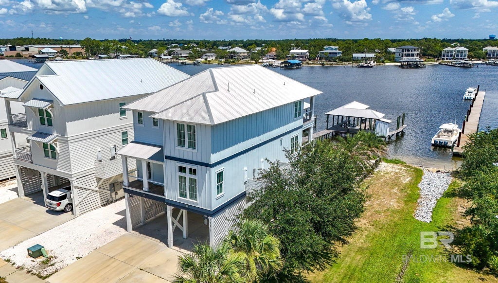
As for marinas and fuel docks, let’s start near the Pass: Zeke’s Landing Marina is a well-known spot just west of Perdido Pass. It’s home to charter fishing boats and offers fuel, a ship store, and a great little seafood eatery – perfect for topping off the tanks or grabbing lunch. Around the corner in Terry Cove are Sportsman Marina and Orange Beach Marina, both catering to larger vessels (with deepwater slips, fuel, and on-site restaurants like Fisher’s and Tacky Jack’s). Heading east along Old River, you’ll come to the legendary Flora-Bama Marina (across from the famed Flora-Bama beach bar at the FL-AL line). It’s a casual spot where you can dock for free while you enjoy a bushwacker, and they also rent pontoon boats and jet skis. On the north side of Ono Island, near Bear Point and Arnica Bay, you’ll find Happy Harbor Marina (also known as Bear Point Marina). Happy Harbor is a family-friendly marina with fuel, a boat ramp, and watersports rentals – from here it’s an easy ride into Bayou St. John or out to Perdido Bay. There’s a popular waterfront restaurant at Bear Point as well (OSO at Bear Point) where you can dock and dine.
Don’t overlook the amenities on Ono Island itself: residents have an exclusive boat launch inside the island (near the water tower) that I use frequently – it’s gated and private, but a fantastic perk if you live on Ono. Ono Island also has two private marinas for property owners (Ono North and Ono Harbour), though these are not public. For visitors or non-resident boaters, sticking to the public launches and marinas mentioned above will cover all your needs.
Lastly, as you cruise around, keep an eye out for services like pump-out stations (most large marinas like Orange Beach Marina offer them) and tow assistance (Sea Tow and TowBoatUS operate in this area – a useful safety net if you venture offshore or into unfamiliar shallows). Our local boating community is close-knit and friendly – it’s not unusual to get a helpful wave or even a tow from a fellow boater if you run into trouble. In short, you’re in good company here on the water.

Final Thoughts: Boating the Ono Island Way
There’s a special rhythm to boating around Ono Island – a blend of vigilance and relaxation. I often start my mornings idling through the Ono canals with a cup of coffee, herons stalking the shoreline, and the sun glinting off glassy water. By midday, I might be navigating the busy channel, greeting charter captains and sailboats as we all respect the buoys and each other’s wakes. Come late afternoon, I love to anchor in a quiet cove, where the shallow sand feels warm between my toes and the laughter of family and friends carries over the bay. This place truly is, as we like to say, a boater’s paradise – but it’s a paradise best enjoyed with a bit of local knowledge and preparation.
I hope this guide has given you both the hard data (depths and clearances) and the practical wisdom (routes and quirks) to boat confidently around Ono Island. As always, stay safe, respect our beautiful waterways, and don’t hesitate to wave me down if you see me out on the water – I’m always happy to share a tip or a story. Until then, I’ll see you between the red and green.
SEARCH ORANGE BEACH REAL ESTATE LISTINGS FOR SALE, Over $1,000,000
#searchthegulf #meredithamon #becausewelivehere
Posted by Meredith Folger Amon on
Leave A Comment