The Coastal Homesite Guide
Before You Build: Wetlands, Soil Testing, Elevations & Coastal Due Diligence
What buyers and sellers should understand before purchasing a homesite on Ono Island, in Orange Beach or elsewhere along the Alabama Gulf Coast.
By Meredith | Gulf Coast Real Estate Advisor & Ono Island Homeowner
_(800_x_150_px)_(2).gif)
Purchasing vacant land along the Alabama Gulf Coast can be an extraordinary opportunity—but a beautiful homesite is not automatically a buildable homesite.
On Ono Island, in Orange Beach and throughout coastal Baldwin County, some of the most important parts of a property are the ones we cannot see from the road. Wetlands, soft soils, undocumented fill, high groundwater, flood-elevation requirements, drainage patterns and shoreline regulations can influence what may be built, where it may be positioned and how much the eventual home could cost.
As an Ono Island homeowner and Gulf Coast real estate advisor, I encourage buyers to evaluate coastal land as both a real estate purchase and a future construction project.
The question is not simply, “Do I love this lot?” It is, “Can I build the home, pool, garage, driveway, dock and outdoor living spaces I envision—at a cost I am comfortable with?”
Wetland Delineation vs. Geotechnical Investigation
These studies are frequently confused, but they answer different questions. A property can present no regulated-wetland concern and still contain soft soils requiring a specialized foundation. Another property may have suitable soils but a limited upland building envelope.
Wetland Delineation
Where are wetlands and other aquatic resources located, and how might they affect the proposed improvements?
Geotechnical Investigation
What is beneath the ground, how will it perform under structural loads and how should the home be supported?
Boundary & Topographic Survey
Where are the boundaries, easements, elevations, setbacks and physical features affecting the property?
Conceptual Site Plan
Can the desired home and supporting improvements fit within the practical, usable building envelope?
What Is a Wetland Delineation?
A qualified environmental consultant or wetland scientist evaluates wetland hydrology, hydric soils and water-tolerant vegetation. When wetland characteristics are present, the consultant typically flags the boundary in the field and prepares mapping and supporting documentation.
The presence of wetlands does not automatically make a property unbuildable. It may mean that part of the property needs to remain undisturbed or that the home, driveway, pool, utilities or dock access must be repositioned. The practical issue is whether the remaining upland area can accommodate the buyer’s plans.
Typical Wetland-Related Planning Costs
| Service | Preliminary Planning Range |
|---|---|
| Desktop wetland screening | $300–$1,000 |
| Small residential-lot field delineation | $1,500–$3,500 |
| Complex, heavily vegetated or larger property | $3,000–$7,500+ |
| Surveying wetland flags onto a survey | $750–$2,500+ |
| Jurisdictional-determination package or agency coordination | $1,000–$4,000+ |
| Permitting, engineering or mitigation | Highly property-specific |
These figures are planning estimates, not quotes. Acreage, vegetation, tidal influence, site access, mapping requirements and agency involvement can materially affect the fee. Mitigation, if required, is separate and can be substantially more expensive.
What Is a Geotechnical Investigation?
A geotechnical investigation evaluates the subsurface conditions beneath the proposed improvements. Depending on the scope, a qualified engineer may use soil borings, Cone Penetration Testing (CPT), groundwater observations, soil classification and laboratory testing.
- Foundation-bearing and settlement recommendations
- Identification of soft layers, organic material or undocumented fill
- Guidance for shallow foundations, driven pilings, helical piles or ground improvement
- Site preparation, compaction and dewatering recommendations
- Testing targeted to a house, pool, garage or other substantial structure
The visible surface tells us very little about how deeply competent soil lies or how the ground may respond to the weight of the completed home. When possible, I prefer to give the engineer a preliminary site plan so the investigation can be positioned around the anticipated footprint—not at arbitrary locations.
Typical Geotechnical Planning Costs
| Service | Preliminary Planning Range |
|---|---|
| Limited residential soil evaluation | $1,500–$3,500 |
| Several borings or CPT soundings with engineering report | $2,500–$6,000 |
| Deeper investigation for raised or pile-supported construction | $4,000–$10,000+ |
| Complex access, added structures or specialized testing | Quoted individually |
| Construction-phase compaction or foundation testing | Usually separate |
Topographic Survey, Ground Elevations & Flood-Elevation Planning
For a vacant homesite, the most useful elevation information generally comes from a current boundary and topographic survey. In addition to confirming the property lines, a qualified surveyor can measure existing ground elevations across the lot and show how the land rises, falls and drains.
Those measurements can then be compared with the property’s FEMA flood zone and Base Flood Elevation, or BFE—the computed elevation floodwater is expected to reach during a flood event having a one-percent chance of occurring or being exceeded in any given year. Local regulations may require the finished floor of a new home to be elevated above the BFE, sometimes with additional height called freeboard.
The Shape of the Land
Spot elevations or contour lines can help identify high and low areas, drainage patterns, shoreline grades, driveway challenges and the relationship between the lot and neighboring properties.
How the Home May Sit
The architect, civil engineer and builder can use surveyed elevations to begin evaluating foundation height, stairs, parking, driveway slope, fill, drainage and the practical relationship between the home and waterfront.
Why Ground Elevations Matter to a Buyer
- They help establish how much the home may need to be elevated.
- They can reveal low areas that may collect water during ordinary coastal rainfall.
- They help the design team evaluate driveway access, stairs, parking and outdoor living areas.
- They support preliminary estimates for fill, grading, drainage and foundation work.
- They allow the buyer to compare the envisioned design with the physical realities of the site.
Why This Information Helps a Seller
A current survey showing topography and ground elevations can make a vacant homesite easier for buyers, builders and architects to evaluate. It gives prospective buyers a more useful starting point, reduces assumptions and may help demonstrate how the property could accommodate a thoughtfully designed coastal home.
Local Companies & Professional Resources
The following firms are examples of professionals offering relevant services in or around coastal Alabama. This is a starting point—not an endorsement or a complete list. Buyers and sellers should confirm qualifications, scope, availability and current pricing directly.
Geotechnical Engineering & Soil Testing
GeoCon Engineering & Materials Testing
Robertsdale-based firm serving Orange Beach and the Gulf Coast with soil borings, CPT, subsurface investigations, foundation engineering and construction-material testing.
Goodwyn Mills Cawood (GMC)
Regional engineering firm offering geotechnical, environmental, civil and infrastructure-related services.
Thompson Engineering
Mobile-based regional firm with geotechnical, environmental, coastal, surveying and construction-testing capabilities.
Terracon
Regional and national provider of subsurface exploration, foundation engineering, environmental services and construction-material testing.
Wetland Delineation & Environmental Consulting
Bay Environmental, LLC
Wetland delineation services in Baldwin, Mobile and Escambia counties.
Barry A. Vittor & Associates / Thompson Engineering
Wetland delineation, permitting, mitigation, biological surveys and related environmental consulting.
Cypress Environment & Infrastructure
Wetland delineation and regulatory assistance throughout Alabama.
Bryant Engineering
Wetland identification, mapping and assistance with state and federal compliance.
Land Surveying & Civil Engineering
Below are several local and regional firms that may provide surveying, civil engineering or related site-development services. This list is offered as a starting point rather than an endorsement or guarantee of availability. I recommend confirming the requested scope, professional licensing, service area, pricing and turnaround time directly with each company.
Weygand Wilson Surveying
Services: Boundary, topographic, construction-layout, subdivision, easement and right-of-way surveys
Address: 229 East 20th Avenue, Suite 10, Gulf Shores, AL 36542
Phone: (251) 975-7555
Email: office@weygandwilson.com
Website: www.weygandwilson.com
Lucido Engineering & Surveying, LLC
Services: Civil engineering, professional land surveying and related site-development services
Address: 24693 Canal Road, Suite A, Orange Beach, AL 36561
Phone: (251) 967-3250
Website: www.lucidoeng.com
Borden Engineering & Surveying
Services: Civil engineering, land surveying and consulting
Address: 8275 State Highway 59, Suite 1, Foley, AL 36535
Phone: (251) 943-1424
Fax: (251) 943-1427
I recommend contacting the office by telephone to confirm its current services and preferred method for requesting an estimate.
Smith, Clark & Associates
Services: Boundary, topographic, wetland, mean-high-water, construction, ALTA/NSPS, subdivision and other professional surveying services
Address: 11111 U.S. Highway 31, Suite F, Spanish Fort, AL 36527
Phone: (251) 626-0404
Email: info@smithclarkllc.com
Website: www.smithclarkllc.com
Thompson Engineering — Orange Beach
Services: Civil, geotechnical, marine and environmental engineering; land surveying; coastal restoration; subsurface investigations; drilling and construction testing
Address: 4830 Main Street, Suite G-212, Orange Beach, AL 36561
Orange Beach Phone: (251) 378-6190
General Phone: (888) 292-2443
Email: info@thompsonengineering.com
Website: www.thompsonengineering.com
Civil Southeast, LLC
Services: Civil engineering, land surveying, project management and ALTA/NSPS surveys
Daphne Mailing Address: P.O. Box 927, Daphne, AL 36526
Phone: (866) 245-0584
Email: info@civilse.com
Website: www.civilse.com
Sawgrass Consulting, LLC
Services: Civil engineering, professional land surveying and construction-management services
Spanish Fort Office: 30673 Sgt. E.I. “Boots” Thomas Drive, Spanish Fort, AL 36527
Mobile Office: 202 Government Street, Suite 225, Mobile, AL 36602
Phone: (251) 544-7900
Website: www.sawgrassllc.com
Contact: Request information online
Contact information was verified where possible on August 10, 2026. Company services, addresses, telephone numbers and availability can change. Please confirm all information directly before relying upon it.
The Coastal Homesite Due-Diligence Checklist
Current Boundary & Topographic Survey
Confirm boundaries, corners, easements, rights-of-way, encroachments, setbacks, elevations, shoreline improvements, utilities and physical features. A recorded plat is not a substitute for a current field survey.
Planning range: approximately $1,000–$3,500+.
Conceptual Site Plan or Buildability Review
Place the proposed home, porches, stairs, garage, parking, driveway, pool, mechanical equipment and waterfront improvements on the survey while accounting for setbacks, wetlands, drainage and construction access.
Planning range: approximately $750–$3,500 for an early concept; detailed civil engineering is separate.
Flood-Zone & Ground-Elevation Review
Verify the FEMA flood zone, Base Flood Elevation, local freeboard and surveyed ground elevations. Ask the architect, civil engineer or builder how these factors could affect foundation height, stairs, parking, driveway design, fill, drainage and the home’s overall relationship to the lot.
Zoning, Setbacks & Restrictive Covenants
Review municipal or county rules together with recorded covenants, owners-association requirements and architectural controls. On Ono Island, confirm the requirements applying to the specific unit and lot directly with the appropriate association.
Utilities & Connection Costs
Obtain written confirmation regarding water, sewer or septic feasibility, electricity, internet, taps, impact fees, capacity, easements and the cost of extending service to the proposed home.
Drainage & Stormwater
Evaluate routine rainfall and how water travels across the property—not simply the FEMA designation. A civil engineer may need to address grading, fill, driveway elevation, retention, neighboring properties and erosion protection.
Dock, Shoreline & Boating Review
Confirm water depth, tidal variation, bridge clearance, turning room, waterway restrictions, dock permitting, dredging limitations, lift capacity, slip dimensions and riparian considerations. An old dock or existing pilings do not automatically establish that replacement or expansion will be approved.
Bulkhead or Shoreline Inspection
Have a marine contractor or coastal engineer evaluate the wall, cap, tiebacks, alignment, drainage and remaining useful life.
Planning range: approximately $300–$1,500 for an initial assessment.
Trees, Vegetation & Environmental History
Consider significant trees, buffers, clearing restrictions and site access. A Phase I Environmental Site Assessment may be appropriate where prior uses involved fuel storage, marina activity, industry, agriculture or dumping.
Title, Easements & Legal Access
Review the title commitment and recorded documents for access, utility and drainage easements, conservation restrictions, shoreline agreements, association obligations, assessments and building restrictions. The title work and survey should be examined together.
Insurance, Financing & Construction Budget
Consult a coastal insurance agent, construction lender, architect, engineer and qualified local builder before the due-diligence period expires. A lot may be buildable while still requiring a construction budget quite different from the buyer’s initial expectation.
A Practical Preliminary Budget
| Due-Diligence Item | Approximate Range |
|---|---|
| Boundary/topographic survey | $1,000–$3,500+ |
| Wetland delineation | $1,500–$3,500+ |
| Geotechnical investigation | $2,500–$6,000+ |
| Conceptual site/buildability plan | $750–$3,500+ |
| Dock or bulkhead consultation | $300–$1,500+ |
| Illustrative combined range | Approximately $6,000–$18,000+ |
A simple lot may require less. A heavily vegetated, wetland-influenced or complex waterfront property may require considerably more. Although this is a meaningful investment, it is modest compared with discovering after closing that specialized foundations, mitigation, extensive fill or shoreline work materially alter the project.
How the Information Helps Buyers and Sellers
Confidence Before Closing
- Clarifies the usable building envelope
- Improves foundation and construction budgeting
- Provides verified ground elevations for site planning
- Identifies wetland, dock and access limitations
- Supports informed design, negotiation or termination rights
- Reduces expensive post-closing surprises
Clarity in the Marketplace
- Reduces uncertainty about buildability and site elevations
- Helps builders, architects and engineers evaluate the property
- Can support stronger marketing and positioning
- May shorten a future buyer’s investigation
- Can reduce contracts failing over unexpected findings
Structuring the Purchase Agreement
When several investigations are required, I prefer a coordinated contingency rather than separate objection periods that expire on different dates. The contract can identify the survey, wetland delineation, geotechnical investigation, conceptual buildability review and dock or bulkhead evaluation, with one clear buyer-review period beginning after the buyer receives the last required report.
The terms must be tailored to the property and transaction. The buyer should understand who selects and pays each professional, the deadline for ordering reports, the delivery requirements, the buyer’s remedies and what happens if testing cannot be completed on time.
My Advice to Coastal Land Buyers
I love helping buyers imagine what a Gulf Coast property could become, but I want that vision supported by surveys, engineering and realistic construction information. Wetlands are not automatically bad. Flood zones are not automatically bad. Raised foundations and pilings are not automatically bad. They are property conditions that should be understood and incorporated into the architecture, construction plan and budget.
The best result comes from matching the right homesite with the right design, foundation, boating amenities and financial plan.
Considering a Gulf Coast Homesite?
I can help you evaluate the real estate considerations and connect you with local surveyors, environmental consultants, engineers, builders and other qualified professionals.
Search Gulf Coast Real Estate
#searchthegulf #meredithamon #becausewelivehere
Search Coastal Alabama Homes and Real Estate For Sale, $800,000 - $900,000
- All Listings
- Under $100,000
- $100,000 - $200,000
- $200,000 - $300,000
- $300,000 - $400,000
- $400,000 - $500,000
- $500,000 - $600,000
- $600,000 - $700,000
- $700,000 - $800,000
- $800,000 - $900,000
- $900,000 - $1,000,000
- Over $1,000,000





.gif)
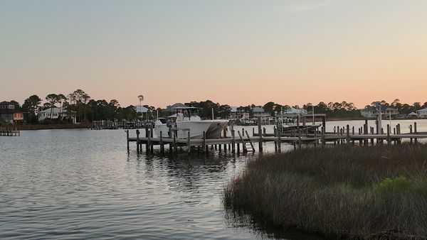

Ono Harbour at Sunset | My Sanctuary on Ono Island
Ono Harbour · Ono Island
Ono Harbour at Sunset
Salt air. Marsh grass. Pretty boats on still water. Soft peach light over the harbour—my sanctuary on Ono Island, so close to Orange Beach.
Ono Harbour Homes Walking the Dock
A Favorite Corner of the Island
Ono Harbour is one of my…
2026 MBGFC Labor Day Invitational | Orange Beach | Search The Gulf

Cotton Bayou Marina Boats | Orange Beach Near Terry Cove
Ask A Question or Sign Up To See New Real Estate Listings Before Your Competition
When it comes to finding the home of your dreams in a fast-paced market, knowing about new listings as soon as they are available is part of our competitive advantage.Sign up to see new listings in an area or specific community. Contact Meredith with any questions you may have.
Enjoy this blog post? Click here to subscribe for updates
Leave A Comment